


Rural Asotin Voting District, Asotin County, Washington
About
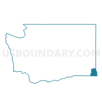
Outline

Summary
| Unique Area Identifier | 683405 |
| Name | Rural Asotin Voting District |
| County | Asotin County |
| State | Washington |
| Area (square miles) | 239.39 |
| Land Area (square miles) | 239.39 |
| Water Area (square miles) | 0.00 |
| % of Land Area | 100.00 |
| % of Water Area | 0.00 |
| Latitude of the Internal Point | 46.27105850 |
| Longtitude of the Internal Point | -117.34863520 |
Maps


Graphs
Select a template below for downloading or customizing gragh for Rural Asotin Voting District, Asotin County, Washington


Neighbors
Neighoring Voting District (by Name) Neighboring Voting District on the Map
- Anatone Voting District, Asotin County, WA
- Clarkston Heights 5 Voting District, Asotin County, WA
- Grouse Voting District, Garfield County, WA
- Peola Voting District, Garfield County, WA
- Water: Grande Ronde River, Asotin County, WA
- Water: Snake River, Asotin County, WA
- West Asotin Voting District, Asotin County, WA
Top 10 Neighboring County Subdivision (by Population) Neighboring County Subdivision on the Map
- Clarkston CCD, Asotin County, WA (17,319)
- Asotin CCD, Asotin County, WA (4,304)
- Snake River CCD, Garfield County, WA (391)
- Imnaha CCD, Wallowa County, OR (244)
- Flora CCD, Wallowa County, OR (117)
Top 10 Neighboring Unified School District (by Population) Neighboring Unified School District on the Map
- Clarkston School District, WA (18,461)
- Asotin-Anatone School District, WA (3,245)
- Enterprise School District 21, OR (3,047)
- Pomeroy School District, WA (2,191)
- Troy School District 54, OR (40)
Top 10 Neighboring State Legislative District Lower Chamber (by Population) Neighboring State Legislative District Lower Chamber on the Map
Top 10 Neighboring State Legislative District Upper Chamber (by Population) Neighboring State Legislative District Upper Chamber on the Map
Top 10 Neighboring 111th Congressional District (by Population) Neighboring 111th Congressional District on the Map
Top 10 Neighboring Census Tract (by Population) Neighboring Census Tract on the Map
- Census Tract 9602, Asotin County, WA (4,542)
- Census Tract 9601, Asotin County, WA (4,304)
- Census Tract 9703, Garfield County, WA (2,266)
- Census Tract 9601, Wallowa County, OR (1,957)
- Census Tract 9602, Wallowa County, OR (1,874)
Top 10 Neighboring 5-Digit ZIP Code Tabulation Area (by Population) Neighboring 5-Digit ZIP Code Tabulation Area on the Map
- 99403, WA (19,548)
- 97828, OR (3,124)
- 99347, WA (2,293)
- 97846, OR (1,891)
- 99402, WA (1,875)
- 99401, WA (273)